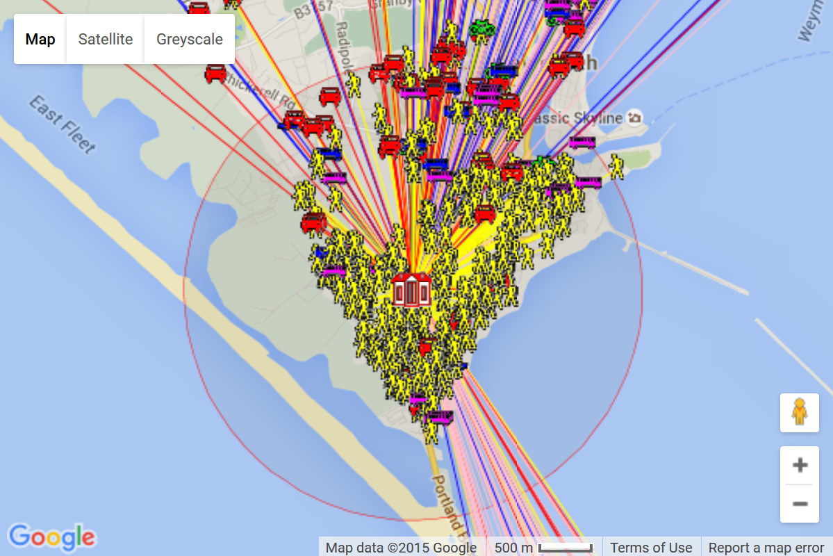
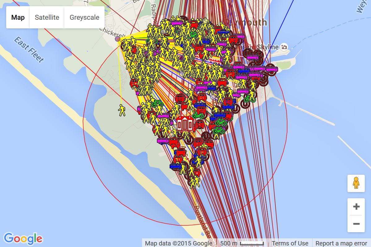
Since the STHC was first commissioned in in 2007-08, it has shown that persistent action by stakeholders is paying off. For example there has been a ~25% reduction in the number of pupils living within a reasonable walking distance of their school but still travelling by car.....
The STHC reveals many other insights into school travel in that can only be derived using spatial analysis. For example did you know that in (the latest analysis results available)...
To find out more interesting spatial analysis facts around school travel in , click on the 'concertinas' below to expand / collapse the contents...
All the STHC analysis tables, charts and maps are made publicly available through this interactive data portal. It utilises free external web-services such as Google Maps and Google Charts, which greatly enhance visualisation of the data at no extra cost to users. Its "thumb friendly" fluid design means it is viewable in any HTML5 compatible browser, including mobile devices.
The STHC Data Portal is arranged into pages contained within different modules, themed by the specific purpose and nature of the analysis (though there may be some overlap between them in terms of the data reported). Additional modules may be added over time, but currently these are:-
The foundation of the STHC output since its' beginning, this module quantifies & visualises how far pupils travel to school, by what mode, and the carbon & calorie footprints of the journeys (if pupil usual mode of travel data has been supplied by the school).
This module quantifies & visualises the proximity of schools to their pupils, pupils to their nearest schools, and schools to each other, as well as "what if.." scenarios (eg. "what if all pupils went to their nearest school?").
This module shows details of all the reported personal injury road accidents that have taken place in the local authority area on public roads with respect to schools. Data is taken from the STATS19 official accident reporting system used by the police.
Note - Clicking on the buttons above will jump to the relevant section on this home page to find out more about each module (or you could just scroll down ;-). Within each section you will also find buttons that link to each page of analysis output within the module. You can also use the menu at the top of this page. Both the buttons and top menu navigation options are available on every page on the portal.
STHC analysis results are visualised in various ways within the portal:-
Maps |
Based on Google maps (so Street View functionality is also built-in), these can be interactively filtered by various analysis-appropriate criteria. |
Headline Statistics |
Key results in an "infographic" style. |
Charts |
Bar Charts show results for the latest analysis year, Line Charts show results for all available years. |
Tables |
These can be interactively filtered by various analysis-appropriate criteria and then re-ordered by individual columns. |
Geo-statistical Atlases |
These interactively combine maps, charts and tables so you can carry out more detailed comparison results between individual schools as well as those for the authority as a whole. |
Reports |
All the relevant maps, tables and charts compiled into a single, "print-friendly" webpage. |
Note - Each page in the portal has an introduction section, a short page walk-through video and "Questions for Debate" so users can quickly learn what it shows and what they should be looking for when it comes tot heir school.
The STHC analysis results are reported at various 'levels' on each page of the portal:-
Individually selected school on its own |
One only of or or or or |
Just the data for the school that has been selected from the drop-down list or a map, along with the results for all schools in the authority as a whole for comparison. |
All schools side-by-side for comparison |
Every one of and and and and |
Results for all individual schools on the one page so they can be compared with each other and ranked. |
All schools by phase |
Total of or or or or |
See how key analysis results compare between different educational phases of school (primary etc.), and individual schools within that phase. |
All schools |
Total of and and and and |
Total figures for all schools aggregated together as a whole. |
Latest year analysed only |
In pages that deal with data about only one school year this will be the most recent year analysed by us. (As we are dealing with school census data, there is an inevitable delay between its collection at source within schools and supply to us by the local authority for analysis.) |
All available years |
See the whole history of analysis results to see individual years as well as trends. |
More About The
STHC Data Portal
Click the button to find out even more about this STHC Data Portal if required. Then once you are confident that you have got the gist of what the portal is all about and how to get around it, click & expand the sections below to start exploring the different data modules that will provide you with more interesting spatial analysis facts around school travel in ...
The STHC Pupil Travel Distance & Mode Analysis module quantifies how far pupils travel to school, from where, by what means & the carbon & calorie footprints of the pupil journeys, and visualises the results as interactive maps, charts and tables. Even where pupils have no recorded mode of travel (their mode is recorded as "Unknown (UNK)"), useful spatial intelligence - such as total & average travel distance, the number of pupils living within a realistic walking distance (the "Walk Threshold") of the school etc.- can still be calculated.
The STHC spatial analysis shows that, on the "school run" for all LA schools in ...
To view the pages in this module, use the buttons below or the "Distance & Mode" menu at the top of the page. Both options are available on every page on the portal.
The STHC Pupil Travel Distance & Mode spatial analysis has many benefits and practical applications:-
BACK TO SECTION TOP
BACK TO TOP OF PAGE
More About The
Pupil Travel
Mode & Distance
Analysis Module
Click the button to find out even more about the Pupil Travel Mode & Distance Analysis Module on this STHC Data Portal if required. Click on one of the buttons at the top of the section to go to a page of interest, or use the header menu....
**This module is still in [BETA] development. We need your feedback & suggestions to help us develop it further for the benefit of all.**
The STHC Proximity & Pupil Choice Analysis module quantifies the proximity of schools to pupils, pupils to schools, and schools to each other, and visualises the results as interactive maps, charts and tables. By looking at the proximity of pupils to ALL schools, not just the one they actually attend, stakeholders can see the consequences of current pupil travel choices and begin to think how they might encourage more pupils to choose their local school rather than travel to schools further afield (often by car).
To view the pages in this module, use the buttons below, or the "Proximity & Choice" menu above. Both options are available on every page on the portal.
There are many practical applications & benefits of the STHC Proximity & Pupil Choice spatial analysis. This list will expand as we further develop the module with the help of our users:-
BACK TO SECTION TOP
BACK TO TOP OF PAGE
More About The
Pupil Proximity
& Choice Analysis
Module
Click the button to find out even more about the Proximity & Pupil Choice Analysis Module on this STHC Data Portal if required. Click on one of the buttons at the top of the section to go to a page of interest, or use the header menu....
**This module is still in [BETA] development. We need your feedback & suggestions to help us develop it further for the benefit of all.**
The STHC Road Traffic Accident Analysis Module quantifies the officially reported road traffic accidents in within set distances of up to 4.8 km from each school, and visualises the results as interactive maps, charts and tables. Accidents all involve casualties and have been recorded via the official police STATS19 reporting system, with available data going back to 2005.
The STHC spatial analysis shows that, for schools in ...
Note - Dorset County Council has an "All-Dorset" interactive online collision map here, that can be filtered by:-
Casualty statistics can be found here.
A breakdown by district or borough can be found here.
To view the pages in this module, use the buttons below, or the "Accidents" menu above. Both options are available on every page on the portal.
There are many practical applications & benefits of the STHC Road Traffic Accident spatial analysis. This list will expand as we further develop the module with the help of our users:-
More About The
Road Traffic
Accident Analysis
ModuleClick the button to find out even more about the Road Traffic Accident Analysis Module on this STHC Data Portal if required. Click on one of the buttons at the top of the section to go to a page of interest, or use the header menu....